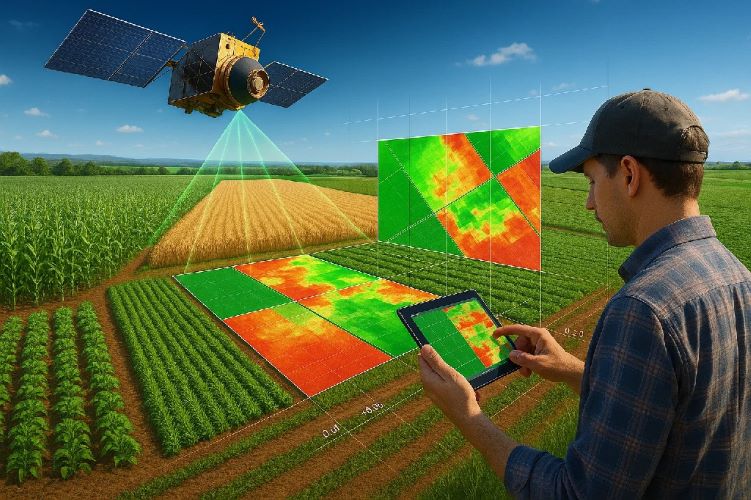
Remote sensing for urban planning applications has revolutionized how cities approach development, environmental management, and infrastructure planning. This comprehensive technology combines satellite imagery, aerial data, and advanced analytics to provide unprecedented insights into urban dynamics, growth patterns, and environmental conditions. Urban planning with satellite remote sensing enables city planners to make data-driven decisions that promote sustainable development, optimize resource allocation, and enhance quality of life for urban populations.
Modern cities face complex challenges including rapid population growth, climate change impacts, resource scarcity, and infrastructure demands. Smart city development using remote sensing addresses these challenges through integrated monitoring systems that provide real-time data and predictive analytics for informed decision-making. The integration of GIS and remote sensing in urban planning creates powerful analytical frameworks that transform raw spatial data into actionable urban intelligence.
What is Remote Sensing in Urban Planning?
Understanding Remote Sensing Technology for Cities
Remote sensing for urban planning applications involves the systematic collection and analysis of data about urban environments using sensors mounted on satellites, aircraft, or drones. These sensors capture electromagnetic radiation across various wavelengths, providing detailed information about land use, vegetation health, surface temperatures, and infrastructure conditions without direct physical contact.
The technology has evolved from simple aerial photography to sophisticated multi-spectral and hyperspectral imaging systems capable of detecting subtle environmental changes and urban development patterns. Modern satellite imagery for city planning provides spatial resolutions ranging from sub-meter to several kilometers, enabling analysis at multiple scales from individual buildings to entire metropolitan regions.
Evolution of Urban Remote Sensing Applications
The evolution of urban planning with satellite remote sensing spans several decades, beginning with aerial photography in the early 20th century and progressing to today’s sophisticated satellite constellations. Early applications focused on basic land use mapping and infrastructure documentation, while modern systems provide real-time monitoring of environmental conditions, population dynamics, and urban growth patterns.
Historical milestones include the launch of Landsat-1 in 1972, which provided the first systematic satellite monitoring of Earth’s surface, and the development of Geographic Information Systems (GIS) in the 1980s that enabled sophisticated spatial analysis. The proliferation of commercial high-resolution satellites in the 2000s democratized access to detailed urban imagery, while recent advances in small satellite technology and cloud computing have made smart city development using remote sensing accessible to municipalities of all sizes.
Benefits of Satellite Data for City Planning
Satellite imagery for city planning offers numerous advantages over traditional ground-based surveying methods. These benefits include comprehensive area coverage, regular temporal monitoring, cost-effectiveness for large areas, and objective data collection that eliminates human bias. Remote sensing data provides consistent, repeatable measurements that enable quantitative analysis of urban change over time.
The technology also supports evidence-based policy making by providing objective documentation of environmental conditions, development patterns, and infrastructure performance. This data-driven approach enhances transparency in urban planning processes and supports sustainable development initiatives through comprehensive environmental monitoring and impact assessment capabilities.
Types of Remote Sensing Data for Urban Applications
Satellite Imagery and Multispectral Analysis
Multispectral satellite imagery forms the foundation of most remote sensing for urban planning applications. Different spectral bands reveal specific information about urban features: visible bands show surface materials and vegetation, near-infrared bands indicate vegetation health and density, and shortwave infrared bands help distinguish between different types of urban surfaces and moisture content.
Advanced sensors like Sentinel-2, Landsat-8, and commercial platforms provide 10-13 spectral bands optimized for land cover analysis. These datasets enable sophisticated classification algorithms that can distinguish between residential, commercial, industrial, and recreational land uses with high accuracy. The combination of multiple spectral bands also allows calculation of vegetation indices like NDVI (Normalized Difference Vegetation Index) that quantify urban green space health and distribution.
LiDAR Technology for 3D City Mapping
Light Detection and Ranging (LiDAR) technology provides precise three-dimensional mapping capabilities essential for urban growth monitoring with remote sensing. Airborne LiDAR systems generate detailed elevation models with vertical accuracy of 10-15 centimeters, enabling accurate building height measurements, flood modeling, and infrastructure planning.
📡 LiDAR vs Traditional Surveying
Traditional Surveying
- ⏱️ Weeks to months
- 👥 Large field teams
- 📍 Point measurements
- 💰 $5-15 per hectare
LiDAR Surveying
- ⚡ Hours to days
- ✈️ Aerial platform
- 🌐 Complete coverage
- 💡 $2-8 per hectare
LiDAR data supports advanced urban analysis including building footprint extraction, urban canyon analysis for wind flow modeling, and precise volume calculations for construction planning. The technology also enables detection of subtle elevation changes that may indicate subsidence or other geotechnical issues affecting urban infrastructure.
Thermal Imaging for Urban Heat Island Detection
Thermal infrared sensors provide critical data for environmental monitoring in urban areas by measuring surface temperatures across cities. Urban heat islands create significant temperature variations that affect energy consumption, air quality, and public health. Thermal remote sensing identifies hotspots and cool zones, enabling targeted interventions to mitigate heat island effects.
Satellite platforms like Landsat-8 and MODIS provide regular thermal imagery that enables long-term monitoring of urban temperature patterns. This data supports climate adaptation planning, green infrastructure design, and energy efficiency programs that reduce urban heat island impacts while improving livability and sustainability.
Night-time Light Data for Population Analysis
Night-time light imagery from satellites like VIIRS and DMSP-OLS provides unique insights into human activity patterns and economic development. Population density mapping techniques using night-time lights enable estimation of population distribution, economic activity levels, and urbanization rates without traditional census data.
These datasets prove particularly valuable for rapidly growing cities where traditional demographic data may be outdated or unavailable. Night-time light analysis supports infrastructure planning, service delivery optimization, and economic development strategies based on observed activity patterns and growth trends.
LiDAR Satellite Imagery: Expediting Infrastructure Planning
Spaceborne LiDAR technology revolutionizes infrastructure planning through precise terrain modeling that reduces project timelines. Modern systems generate detailed elevation models with 10-15 centimeter accuracy, supporting highway alignment and utility corridor design.
Advanced Planning Applications
The technology maps 81 square kilometers per day, providing comprehensive terrain data for engineering analysis. Remote sensing in urban planning increasingly incorporates LiDAR for automated obstacle detection and line-of-sight analysis in telecommunications and power transmission projects.
Cost-Effective Implementation
Integration with traditional surveying methods provides optimal results while reducing costs by 20-40%. The combination creates comprehensive planning datasets supporting detailed infrastructure design across multiple jurisdictions.
Core Urban Planning Applications
Urban Sprawl Monitoring and Growth Analysis
Urban growth monitoring with remote sensing provides comprehensive documentation of city expansion patterns, development density, and land conversion rates. Time-series analysis of satellite imagery reveals sprawl patterns, infill development trends, and the effectiveness of growth management policies over multiple decades.
Automated change detection algorithms can identify new development, quantify sprawl rates, and predict future growth scenarios based on historical patterns. This information supports comprehensive planning efforts, infrastructure investment decisions, and policy development aimed at promoting sustainable urban development patterns.
Land Use Classification and Zoning
Detailed land use mapping through satellite imagery for city planning enables accurate inventory of residential, commercial, industrial, and recreational areas. Advanced classification algorithms using machine learning techniques can distinguish between different urban land use types with accuracy exceeding 90% when properly calibrated.
Automated land use classification supports zoning compliance monitoring, tax assessment accuracy, and policy development based on actual land use patterns rather than outdated zoning maps. Regular updates ensure planning decisions reflect current conditions and emerging development trends.
Transportation Network Planning
Remote sensing for urban planning applications supports transportation system analysis through detailed mapping of roads, transit lines, parking areas, and traffic patterns. High-resolution imagery enables accurate measurement of road widths, intersection geometry, and connectivity metrics that inform transportation planning decisions.
Combining satellite imagery with traffic flow data and demographic information creates comprehensive transportation models that support infrastructure investment decisions, route optimization, and multimodal transportation planning initiatives.
Green Space Management and Planning
Urban vegetation monitoring through GIS and remote sensing in urban planning quantifies green space distribution, vegetation health, and ecosystem services provision. Vegetation indices calculated from multispectral imagery provide objective measures of urban forest health and canopy coverage changes over time.
This information supports urban forestry management, park planning, and green infrastructure development that enhances environmental quality and climate resilience. Regular monitoring enables adaptive management strategies that maintain and enhance urban ecosystem services.
GIS Integration with Remote Sensing Data
Spatial Data Management and Analysis
Geographic Information Systems provide the analytical framework for integrating remote sensing for urban planning applications with other spatial datasets including cadastral information, infrastructure networks, and demographic data. GIS platforms enable sophisticated spatial analysis that reveals relationships between different urban systems and processes.
Effective data management strategies ensure remote sensing data remains accessible, up-to-date, and properly integrated with existing municipal databases. Cloud-based GIS platforms increasingly provide scalable solutions that accommodate large remote sensing datasets while maintaining system performance.
Multi-layer Urban Analysis Techniques
Advanced GIS analysis techniques combine multiple data layers to reveal complex urban patterns and relationships. Overlay analysis identifies areas where different urban systems intersect, such as transportation corridors passing through environmentally sensitive areas or high-density development near flood zones.
Spatial modeling techniques including suitability analysis, network analysis, and spatial statistics provide quantitative frameworks for evaluating urban planning scenarios and their potential impacts. These analytical capabilities support evidence-based decision making and help planners optimize urban development patterns.
Environmental Impact Assessment Tools
Environmental monitoring in urban areas benefits significantly from GIS-based impact assessment tools that combine remote sensing data with environmental models. These tools evaluate potential impacts of proposed developments on air quality, water resources, wildlife habitat, and ecosystem services.
Predictive modeling capabilities enable assessment of cumulative impacts from multiple development projects and support mitigation planning that minimizes environmental degradation while accommodating necessary urban growth.
Infrastructure Planning and Management
GIS integration supports comprehensive infrastructure planning by combining satellite imagery for city planning with detailed asset inventories and performance data. This integrated approach enables optimization of infrastructure investments, identification of service gaps, and prediction of maintenance needs.
Asset management systems powered by GIS and remote sensing data provide real-time information about infrastructure condition and performance, enabling proactive maintenance strategies that extend asset life and reduce lifecycle costs.
Ready to transform your city planning with advanced remote sensing technology? Contact GeoScience for expert consultation on smart city development.
GIS and Remote Sensing in Urban Transportation Planning
Modern transportation planning increasingly integrates geospatial technology with smart mobility infrastructure. Transportation planners rely on satellite imagery analysis to optimize route networks and design sustainable systems for growing urban populations.
Real-Time Traffic Analysis and Network Optimization
Cities implementing integrated geospatial transportation systems achieve 15-25% reduction in commute times through optimized traffic flow management. The application of remote sensing and GIS in transportation enables continuous monitoring of traffic density and congestion patterns through high-resolution satellite imagery combined with IoT sensors.
Urban Remote Sensing for Mobility Planning
Urban remote sensing applications support comprehensive analysis of public transit systems and cycling infrastructure through detailed corridor mapping. This approach facilitates evidence-based decisions about infrastructure investments while supporting sustainable urban mobility plans that reduce car dependency.
Infrastructure Asset Management
Advanced systems automatically identify road surface conditions and infrastructure assets from satellite imagery, enabling proactive maintenance scheduling. Remote sensing for urban planning extends beyond traffic analysis to include comprehensive transportation asset monitoring and lifecycle management.
Remote Sensing Applications 2025: Smart City Development
IoT Integration with Remote Sensing
Smart city technologies and applications increasingly integrate Internet of Things (IoT) sensors with remote sensing data to create comprehensive monitoring networks. Ground-based sensors provide real-time data on air quality, noise levels, traffic flow, and energy consumption, while satellite and aerial platforms provide broader spatial context and historical trends.
This integration enables real-time decision making supported by both immediate sensor readings and broader spatial patterns revealed through remote sensing analysis. Smart city platforms use this combined data to optimize city services, reduce resource consumption, and improve quality of life for residents.
Real-time Environmental Monitoring
Environmental monitoring systems combine satellite imagery for city planning with distributed sensor networks to provide continuous assessment of urban environmental conditions. Real-time air quality monitoring, water quality assessment, and noise level tracking enable immediate response to environmental threats and support public health protection.
Automated alert systems notify city officials when environmental conditions exceed safe thresholds, enabling rapid response to pollution events, heat waves, or other environmental hazards. This real-time capability transforms reactive environmental management into proactive protection of public health and environmental quality.
AI and Machine Learning Applications
Artificial intelligence and machine learning algorithms revolutionize urban growth monitoring with remote sensing by automating pattern recognition, change detection, and predictive modeling. Deep learning models can classify land use with unprecedented accuracy, identify illegal construction, and predict urban growth patterns based on historical trends and driving factors.
Machine learning algorithms process vast amounts of satellite imagery to extract actionable information faster and more accurately than traditional methods. These capabilities enable continuous monitoring of large urban areas and automatic detection of changes that require planning attention or regulatory enforcement.
🤖 AI Applications in Urban Planning
Automated Detection
- 🏗️ Illegal construction
- 🌳 Deforestation events
- 🚧 Infrastructure damage
- 📈 Land use changes
Predictive Analytics
- 📈 Growth forecasting
- 🌡️ Climate impacts
- 🚦 Traffic patterns
- 💧 Resource demands
Real-time Processing
- ⚠️ Emergency response
- 🌊 Flood monitoring
- 🔥 Fire detection
- 📱 Mobile alerts
Digital Twin City Models
Digital twin technology represents the pinnacle of smart city development using remote sensing by creating real-time virtual replicas of urban environments. These models integrate satellite imagery, IoT sensor data, and urban information systems to provide comprehensive platforms for scenario planning, impact assessment, and operational optimization.
Digital twins enable planners to test different development scenarios, evaluate policy impacts, and optimize city operations before implementing changes in the physical environment. This capability significantly reduces implementation risks and improves decision-making quality through evidence-based scenario analysis.
Environmental Monitoring and Management
Air Quality Assessment and Monitoring
Environmental monitoring in urban areas relies heavily on remote sensing data to assess air quality conditions and identify pollution sources. Satellite sensors can detect various air pollutants including nitrogen dioxide, sulfur dioxide, particulate matter, and ozone concentrations across urban areas.
Ground-based monitoring networks combined with satellite observations provide comprehensive air quality assessment capabilities that support public health protection and environmental regulation enforcement. Real-time air quality data enables dynamic traffic management, industrial emission controls, and public health advisories during pollution episodes.
Water Resource Management
Urban water resource management benefits significantly from satellite imagery for city planning through monitoring of water bodies, watershed conditions, and infrastructure performance. Remote sensing data tracks water quality parameters, identifies pollution sources, and monitors changes in water availability and distribution systems.
Flood risk assessment using satellite data and digital elevation models provides critical information for infrastructure planning and emergency preparedness. Regular monitoring of urban watersheds enables proactive management of water resources and early warning of potential supply disruptions.
Urban Heat Island Mitigation Strategies
Thermal remote sensing provides essential data for understanding and mitigating urban heat island effects that affect energy consumption, public health, and environmental quality. Urban heat island remote sensing identifies temperature patterns, evaluates cooling strategies, and monitors the effectiveness of mitigation measures.
Green infrastructure planning uses thermal imagery to optimize placement of parks, green roofs, and tree canopy to maximize cooling benefits. This data-driven approach to heat island mitigation improves cost-effectiveness of cooling strategies while enhancing urban livability.
Disaster Risk Assessment and Management
Remote sensing technology provides critical capabilities for GIS applications for municipal planning related to disaster risk assessment and emergency management. Satellite imagery enables mapping of flood-prone areas, wildfire risk zones, earthquake vulnerability, and other natural hazards that affect urban planning decisions.
Post-disaster damage assessment using before-and-after satellite imagery supports rapid response efforts, insurance claims processing, and recovery planning. Real-time monitoring during disasters enables dynamic evacuation planning and resource allocation based on evolving conditions.
Advanced Applications and Technologies
Population Density Estimation Techniques
Population density mapping techniques using remote sensing data provide valuable demographic information for cities lacking current census data. Night-time light imagery, building footprint analysis, and land use classification enable estimation of population distribution and density patterns across urban areas.
These techniques prove particularly valuable for rapidly growing cities where traditional demographic surveys may be outdated or incomplete. Population estimates support infrastructure planning, service delivery optimization, and resource allocation decisions based on actual settlement patterns rather than administrative boundaries.
Economic Activity Monitoring
Remote sensing data provides unique insights into economic activity patterns through analysis of night-time lights, industrial emissions, transportation activity, and commercial development. Smart city technologies and applications use these indicators to monitor economic trends, identify growth sectors, and evaluate policy effectiveness.
Commercial satellite imagery can track construction activity, port operations, mining activities, and agricultural production to provide real-time economic indicators that complement traditional statistical data. This information supports economic development planning and investment decisions.
Urban Growth Prediction Models
Predictive modeling using urban growth monitoring with remote sensing data enables forecasting of future development patterns based on historical trends, infrastructure availability, and policy scenarios. Machine learning models trained on historical satellite imagery can predict where and how fast urban growth will occur under different conditions.
These predictive capabilities support long-range planning efforts, infrastructure investment strategies, and policy development aimed at managing growth in sustainable ways. Scenario modeling enables evaluation of different policy options and their likely impacts on urban development patterns.
🎯 Urban Growth Prediction Accuracy
| Prediction Method | Accuracy | Time Horizon | Data Requirements | Cost per hectare |
|---|---|---|---|---|
| Traditional Surveys | 65-75% | 5-10 years | High | $500-800 |
| Satellite + GIS | 80-85% | 10-15 years | Medium | $50-150 |
| AI + Machine Learning | 85-92% | 15-20 years | High | $100-300 |
| Digital Twin + IoT | 90-95% | 20+ years | Very High | $200-500 |
* Accuracy rates based on validation studies from 2020-2024
** Costs include setup, data acquisition, and processing per hectare
Climate Change Adaptation Planning
Climate adaptation planning increasingly relies on remote sensing for urban planning applications to assess vulnerability, monitor impacts, and evaluate adaptation strategies. Satellite data provides essential information about sea level rise, extreme weather patterns, and ecosystem changes that affect urban planning decisions.
Long-term monitoring of climate indicators supports development of adaptation strategies that build urban resilience to climate impacts. This information enables proactive planning that reduces vulnerability while maintaining economic vitality and quality of life.
Implementation Challenges and Solutions
Data Quality and Resolution Considerations
Effective implementation of satellite imagery for city planning requires careful consideration of data quality and resolution requirements for specific applications. High-resolution imagery may be necessary for detailed infrastructure planning, while moderate resolution data may suffice for regional growth monitoring.
Data validation and quality control procedures ensure remote sensing data meets accuracy standards for planning applications. Integration with ground-truth data improves reliability and builds confidence in remote sensing-based planning decisions.
Technical Infrastructure Requirements
Successful deployment of smart city technologies and applications requires robust technical infrastructure including high-speed internet connectivity, cloud computing resources, and skilled technical personnel. Cities must invest in IT infrastructure that can handle large satellite datasets and support real-time processing requirements.
Partnership with technology providers can help cities access advanced capabilities without large upfront investments in specialized hardware and software. Cloud-based platforms increasingly provide scalable solutions that grow with city needs and technological advances.
Cost-Benefit Analysis for Municipalities
Economic analysis of GIS and remote sensing in urban planning investments demonstrates significant returns through improved decision-making, reduced infrastructure costs, and enhanced service delivery. Cost savings from avoiding poor planning decisions often exceed technology investment costs within 3-5 years.
Budget planning for remote sensing programs should consider both initial setup costs and ongoing operational expenses including data acquisition, software licensing, and staff training. Phased implementation strategies help spread costs while building capabilities incrementally.
Staff Training and Capacity Building
Successful implementation requires comprehensive training programs that build technical capacity among planning staff. Remote sensing for urban planning applications involves specialized skills in data analysis, software operation, and interpretation of spatial information.
Partnerships with universities and professional organizations provide ongoing education and skill development opportunities. Staff certification programs ensure technical competency and keep pace with rapidly evolving technology capabilities.
Case Studies: Successful Smart City Implementations
Mexico City Urban Growth Management
Mexico City has implemented comprehensive urban growth monitoring with remote sensing programs that track sprawl patterns, monitor environmental conditions, and support regional planning coordination. Satellite imagery analysis reveals growth trends and their impacts on transportation systems, water resources, and air quality.
The integration of remote sensing data with demographic information and infrastructure planning has improved coordination between different government agencies and supported more sustainable development patterns across the metropolitan region.
Puerto Vallarta Coastal Development Planning
Puerto Vallarta utilizes satellite imagery for city planning to manage coastal development while preserving environmental quality and tourism appeal. Remote sensing data monitors beach erosion, tracks urban expansion, and evaluates the effectiveness of environmental protection measures.
The city’s experience demonstrates how smaller municipalities can leverage remote sensing technology to address complex planning challenges including tourism impacts, environmental protection, and infrastructure development in sensitive coastal environments.
International Smart City Success Stories
Cities worldwide demonstrate successful implementation of smart city development using remote sensing across diverse contexts and scales. Singapore’s comprehensive monitoring system combines satellite data with IoT sensors to manage urban growth and environmental quality. Barcelona uses remote sensing for green infrastructure planning and climate adaptation strategies.
These international examples provide valuable lessons about implementation strategies, technology selection, and organizational approaches that maximize the benefits of remote sensing technology for urban planning applications.
Lessons Learned and Best Practices
Successful implementations emphasize the importance of clear planning objectives, stakeholder engagement, and incremental capability building. Environmental monitoring in urban areas requires long-term commitment and consistent data collection to provide meaningful insights for planning decisions.
Best practices include starting with pilot projects, building partnerships with technology providers, and investing in staff training before expanding to comprehensive city-wide systems. Regular evaluation and adaptation of technology systems ensures they continue meeting evolving planning needs.
Technology Integration and Workflows
Google Earth Engine for Urban Analysis
Google Earth Engine provides powerful cloud-based capabilities for processing large volumes of satellite imagery for urban planning with satellite remote sensing applications. The platform enables rapid analysis of decades of satellite data to identify trends, detect changes, and model urban development patterns.
Automated processing workflows can monitor multiple cities simultaneously and generate regular reports on urban growth, environmental conditions, and infrastructure performance. This capability makes comprehensive monitoring affordable for cities of all sizes.
QGIS and Open Source Solutions
Open source GIS platforms like QGIS provide cost-effective solutions for GIS applications for municipal planning that integrate remote sensing data with other spatial information. These platforms offer professional-grade analytical capabilities without licensing costs that may limit access for smaller municipalities.
Community-driven development ensures open source tools continue evolving to meet user needs while maintaining compatibility with commercial data sources and software platforms. Training resources and user communities provide support for implementation and skill development.
Commercial Software Platforms
Commercial platforms offer specialized capabilities for smart city technologies and applications including advanced analytics, real-time processing, and integration with enterprise systems. These solutions provide comprehensive support and regular updates that ensure optimal performance and security.
Vendor partnerships can provide implementation support, training, and ongoing technical assistance that accelerates deployment and maximizes return on investment. Evaluation of commercial options should consider total cost of ownership including training, support, and upgrade costs.
Cloud Computing and Big Data Processing
Cloud computing platforms enable processing of massive satellite datasets that exceed the capacity of local computing resources. Remote sensing for urban planning applications increasingly relies on cloud infrastructure that provides scalable processing power and storage capacity.
Big data analytics capabilities enable analysis of multiple data streams simultaneously including satellite imagery, IoT sensors, and administrative databases. This comprehensive approach provides holistic insights that support integrated urban planning and management decisions.
Transform your city with cutting-edge remote sensing and GIS solutions. Get expert guidance from GeoScience’s urban planning specialists.
Future of Urban Remote Sensing
Nanosatellites and SmallSat Constellations
The future of satellite imagery for city planning will be shaped by proliferation of small satellite constellations that provide high-frequency monitoring at reduced costs. These «smallsats» offer daily or even hourly revisit times that enable near real-time monitoring of urban conditions and rapid response to changing situations.
Miniaturization of sensors maintains data quality while reducing launch costs and mission complexity. This democratization of satellite technology makes comprehensive urban monitoring accessible to municipalities worldwide regardless of budget constraints.
Real-time Processing Capabilities
Advances in cloud computing and edge processing enable real-time analysis of satellite data for immediate decision-making support. Smart city development using remote sensing will increasingly rely on automated analysis pipelines that generate alerts and recommendations within hours of data acquisition.
Real-time capabilities particularly benefit emergency response, environmental monitoring, and traffic management applications where immediate information provides significant value. Integration with mobile devices and decision support systems ensures critical information reaches decision-makers immediately.
AI-Powered Urban Analytics
Artificial intelligence will continue transforming urban growth monitoring with remote sensing through increasingly sophisticated pattern recognition, predictive modeling, and automated decision support capabilities. Deep learning models will enable automatic detection of complex urban phenomena that currently require manual interpretation.
AI-powered analytics will integrate multiple data sources including satellite imagery, social media, economic indicators, and IoT sensors to provide comprehensive urban intelligence that supports evidence-based planning and management decisions.
Autonomous Urban Monitoring Systems
Future systems will operate with minimal human intervention, automatically collecting data, detecting changes, and generating recommendations based on predefined criteria and learned patterns. Environmental monitoring in urban areas will become increasingly automated with AI systems managing sensor networks and satellite data processing.
Autonomous systems will enable continuous monitoring of urban conditions with immediate alerts for anomalies or situations requiring human attention. This capability will dramatically improve response times while reducing operational costs for comprehensive urban monitoring programs.
Implementation Guide for City Planners
Getting Started with Remote Sensing
Cities beginning remote sensing for urban planning applications should start with clearly defined objectives and pilot projects that demonstrate value before expanding to comprehensive systems. Initial applications might focus on single issues like growth monitoring or environmental assessment before integrating multiple data streams.
Partnership with experienced technology providers can accelerate implementation while building internal capabilities. Universities and research institutions often provide valuable technical support and training opportunities for municipal staff.
Building Technical Capacity
Successful implementation requires investment in staff training and technical infrastructure that supports remote sensing applications. GIS applications for municipal planning require specialized skills in spatial analysis, data management, and interpretation of remote sensing data.
Training programs should combine technical skills with understanding of planning applications to ensure staff can effectively use remote sensing data for decision-making. Ongoing education keeps pace with rapidly evolving technology capabilities and best practices.
Selecting Appropriate Technologies
Technology selection should align with specific planning objectives, available budget, and technical capacity. Smart city technologies and applications offer many options ranging from simple data visualization to complex predictive modeling systems.
Phased implementation strategies allow cities to start with basic capabilities and expand over time as experience and budget permit. Careful evaluation of vendor capabilities and long-term support ensures technology investments provide lasting value.
Creating Sustainable Monitoring Programs
Long-term success requires sustainable funding models, ongoing data acquisition agreements, and continuous system maintenance. Urban planning with satellite remote sensing provides greatest value through consistent long-term monitoring rather than one-time analyses.
Integration with existing planning processes and decision-making workflows ensures remote sensing data becomes integral to municipal operations rather than an isolated technical capability. Regular evaluation and system updates maintain effectiveness as technology and planning needs evolve.
Economic and Social Impact
ROI of Smart City Technologies
Economic analysis demonstrates significant returns from investments in smart city development using remote sensing through improved decision-making, reduced infrastructure costs, and enhanced service delivery efficiency. Cost savings from avoiding poor planning decisions often exceed technology investment costs within 3-5 years.
Additional benefits include improved economic development outcomes, reduced environmental compliance costs, and enhanced quality of life that attracts residents and businesses. These indirect benefits often exceed direct cost savings but require longer time horizons to fully realize.
Improved Quality of Life Metrics
Environmental monitoring in urban areas using remote sensing technology directly supports quality of life improvements through better air quality management, reduced flood risks, and optimized green space planning. Objective monitoring data enables targeted interventions that address specific quality of life challenges.
Transparent reporting of environmental conditions builds public trust and demonstrates municipal commitment to resident wellbeing. Real-time information enables residents to make informed decisions about outdoor activities and health protection during pollution episodes.
Sustainable Development Goals Achievement
Remote sensing technology supports achievement of multiple UN Sustainable Development Goals including sustainable cities and communities, climate action, and environmental protection. Urban growth monitoring with remote sensing provides essential data for tracking progress toward sustainability targets.
Comprehensive monitoring enables evidence-based policies that balance economic development with environmental protection and social equity. This data-driven approach improves policy effectiveness while demonstrating accountability to residents and funding agencies.
Community Engagement and Transparency
Public access to remote sensing data and analysis results enhances government transparency and enables informed citizen participation in planning processes. Interactive mapping platforms allow residents to explore data and understand planning decisions affecting their communities.
Citizen science initiatives can integrate community observations with remote sensing data to improve monitoring accuracy and build public engagement with planning processes. This participatory approach builds support for planning decisions while improving data quality through local knowledge integration.
FAQs – Remote Sensing for Urban Planning
What is remote sensing in urban planning and how does it work?
Remote sensing in urban planning involves collecting and analyzing data about cities using satellite imagery, aerial photography, and drone surveys without direct physical contact. The technology captures electromagnetic radiation across different wavelengths to reveal information about land use, vegetation health, surface temperatures, and infrastructure conditions. Modern systems combine multispectral satellite imagery with GIS analysis to create comprehensive urban intelligence platforms that support evidence-based planning decisions.
How accurate is satellite imagery for city planning compared to traditional surveying?
Satellite imagery for city planning achieves 85-95% accuracy for land use classification and urban change detection when properly calibrated with ground-truth data. While traditional surveying provides higher point-specific accuracy (centimeter-level), satellite remote sensing offers superior area coverage and cost-effectiveness for large-scale planning applications. For comprehensive urban monitoring, satellite data provides consistent accuracy of 1-5 meters spatial resolution, which meets requirements for most municipal planning applications at significantly lower costs than traditional methods.
What are the main benefits of using remote sensing for smart city development?
Smart city development using remote sensing provides multiple benefits including comprehensive area monitoring, cost-effective data collection, objective environmental assessment, and real-time change detection. Cities gain capabilities for urban growth monitoring, environmental impact assessment, infrastructure planning, and disaster risk management through integrated satellite and IoT sensor networks. The technology enables evidence-based policy making, improves transparency in planning processes, and supports sustainable development initiatives while reducing operational costs compared to traditional ground-based monitoring methods.
How much does remote sensing technology cost for municipal planning applications?
Remote sensing technology costs vary significantly based on data requirements, processing complexity, and system scale. Basic satellite imagery analysis starts at $2,000-5,000 annually for small municipalities, while comprehensive smart city platforms range from $50,000-200,000 for setup and $20,000-50,000 annually for operation. Cloud-based solutions reduce upfront infrastructure costs, and open-source platforms like Google Earth Engine provide free processing capabilities. Most cities achieve positive ROI within 3-5 years through improved decision-making and reduced infrastructure costs.
What types of satellite data are best for urban planning applications?
Urban planning applications benefit from multiple satellite data types including multispectral imagery (Landsat-8, Sentinel-2) for land use classification, high-resolution optical imagery (WorldView, Quickbird) for detailed infrastructure mapping, thermal infrared data for urban heat island analysis, and night-time light data for population density estimation. LiDAR provides precise 3D mapping for flood modeling and building height analysis. The optimal combination depends on specific planning objectives, required accuracy, and available budget for data acquisition and processing.
How can small cities implement remote sensing without large technical teams?
Small cities can implement remote sensing through cloud-based platforms, partnerships with technology providers, and phased deployment strategies that build capabilities incrementally. Google Earth Engine provides free access to satellite imagery and processing tools, while commercial platforms offer turnkey solutions with technical support. Universities and regional planning organizations often provide training and technical assistance. Starting with pilot projects focusing on specific issues like growth monitoring or environmental assessment demonstrates value before expanding to comprehensive systems.
What are the privacy and security considerations for smart city remote sensing?
Smart city remote sensing systems must comply with privacy regulations while maintaining data security through encrypted transmission, secure storage, and access controls. Satellite imagery generally doesn’t raise privacy concerns due to resolution limitations, but integration with ground-based sensors requires careful privacy protection measures. Cities should implement clear data governance policies, public notification procedures, and transparent reporting about data collection and use. Cybersecurity measures include regular security audits, system updates, and staff training on data protection protocols.
How does remote sensing support climate change adaptation planning?
Remote sensing provides essential data for climate adaptation planning through monitoring of sea level rise, extreme weather impacts, urban heat islands, and ecosystem changes. Satellite data enables assessment of vulnerability, tracking of environmental trends, and evaluation of adaptation strategy effectiveness. Thermal imagery identifies heat island hotspots for cooling interventions, while elevation data supports flood risk modeling. Long-term monitoring capabilities enable cities to track climate impacts and adapt planning strategies based on observed changes rather than projections alone.
Can remote sensing detect illegal construction and zoning violations?
Yes, remote sensing enables automated detection of unauthorized construction through change detection algorithms that compare current imagery with previous conditions and approved development plans. Machine learning models can identify new buildings, land clearing, and infrastructure changes with 80-90% accuracy when properly trained. Automated alerts notify planning officials of potential violations for field verification. This capability significantly improves code enforcement efficiency while providing objective documentation for regulatory actions.
What’s the future of remote sensing technology for urban planning?
The future includes real-time processing capabilities, AI-powered analytics, autonomous monitoring systems, and integration with digital twin city models. Small satellite constellations will provide daily or hourly updates, while machine learning algorithms will automate pattern recognition and predictive modeling. Digital twins will enable virtual scenario testing before implementing real-world changes. Edge computing will enable immediate analysis and response, while integration with IoT sensors will create comprehensive urban intelligence platforms that transform reactive planning into proactive city management.